The Planning and Engineering Study for Housing Sites in Yuen Long South - Investigation was completed. The information in this website has been archived and will not be updated. Please visit the following website for the latest information on Yuen Long South Development Area: https://www.yls.hk
Study Overview

Constraints and Key Issues
1. Proliferation of Open Storage Yards, Warehouses, Workshops & Industrial Uses
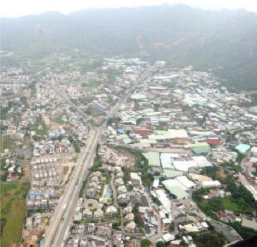
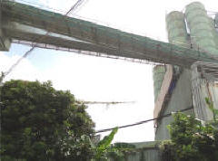
The warehouses, open storage yards, waste recycling workshops, vehicle repair workshops, etc. in the PDAs are mostly housed in temporary structures. There is also a cluster of industrial operations, including concrete batching plants, in the PDA in the Tong Yan San Tsuen area.
While these uses provide job opportunities, proliferation of these uses has also led to degradation of the environment with problems such as pollution, localised flooding, traffic congestion, fire hazard and industrial/ residential interface problems. The Study provides an opportunity to review the degraded brownfield and under-utilised land for more beneficial uses, and improving the local environment.
 |
 |
|
|
2. Existing Villages and Residential Developments
There are existing residential uses within and to the immediate surroundings of the PDA, comprising mostly low-rise residential estates and village settlements of indigenous and non-indigenous villages.
Within the PDA, clusters of these low-rise residential developments are found mainly along Sha Tseng Road and Tong Yan San Tsuen Road, and in the upper North of the PDA in the area near Kung Um Road.
These well-established existing residential communities would be taken in account when formulating the development proposals.
|
|
|
|
|
|
|
|
3. Environment
Environmental impacts of Yuen Long Highway, concrete batching plant, open storage use, workshops, livestock farms, etc. might pose constraints on the development. The Study will look into measures to address the environmental problems.
There are natural landscape features such as woodland and active agricultural land that warrant preservation. Given the long history of Yuen Long, various cultural heritage features are also found in the Study Area. These features should be considered in formulating the development options.
Yuen Long South also falls into mainly the Urban Climatic Planning Zone 2 under the Urban Climatic Map and Standards for Wind Environment - Feasibility Study. Planning and design measures such as breezeways and greening will be explored to create a sustainable living environment.
|
|
|
4. Traffic
Yuen Long South is conveniently connected with the urban area via Tai Lam Tunnel, and to the other parts of the New Territories via San Tin Highway and Yuen Long Highway. Nevertheless, the PDAs currently do not have direct access to Yuen Long Highway, and are also not served by railway.
Yuen Long Highway has limited capacity at present. Additional transport infrastructures and/or improvement works will be needed to accommodate Yuen Long South developments.
Kung Um Road provides the only major road access running through the PDA in the Tai Tong area. Its narrow road width and heavy use by large goods vehicles pose safety problems. Opportunities to improve the design of Kung Um Road through widening or realigning of the road by decking over part of the Yuen Long Nullah will be explored.
Traffic capacity of both external and local road links would be a key issue to be examined in the study. The review of external links will take into account the future developments at Yuen Long South and in the vicinity. Potentials for improving the traffic capacity and connectivity to the surroundings will also be explored.
|
|
|
|
|
|
5. Drainage and Sewerage
Drainage
The Study Area covers two major drainage channels, namely the Yuen Long Nullah and Tin Tsuen Channel, and there have been no major flooding events in Yuen Long and the surrounding areas in recent years. This Study will review the adequacy of the drainage system and propose appropriate mitigation measures to ensure no increase in flooding risks, and evaluate the possibility of enhancing the aesthetic attractiveness of these functional facilities.
|
|
|
Sewerage
The Yuen Long South area is mainly served by the San Wai Sewage Treatment Works, where part of the PDA in the Tong Yan San Tsuen area is also served by the Yuen Long Sewage Treatment Works. No sewage treatment facilities are provided in the PDA in the Tai Tong Area and sewage generated is generally disposed of by means of septic tank systems or illegally discharged to Yuen Long Nullah.
This Study will review the loading capacity of the existing facilities such that there is no net increase in pollution discharged to Deep Bay, enhance the capacity of the sewerage facilities, and propose new main sewerage network through the undertaking of sewerage impact assessment in order to improve the sanitary conditions of the area and the water quality of the nullahs.
|
|
|
6. Cavities
The PDA is located within areas known to be underlain by marble that can include challenging sub-surface features such as cavities and voids containing weak and unconsolidated material as well as highly variable rock head profiles. Which such features can present a constraint to the building construction, they are well known and understood by the engineering community in Hong Kong.
Back7. Land Ownership
The PDA cover about 223ha of land, with 82% being private land and the remaining 18% being Government land. Similar to most rural land in the New Territories, most of the private land is irregular in shape, under multiple ownership and some is held under “tso tong”. There are also graves within the PDA. These issues have implications on implementation.
Majority of Government land is occupied by roads, nullahs, hilly knolls, and infrastructure. Therefore, Government land available for new developments in the PDA is limited.
Back8. Urban Planning and Design Context
The development intensity decreases from the urban centres at Yuen Long New Town and Tin Shui Wai New Town towards the Yuen Long South area. The surrounding context sets the scene for the future planning and urban design of the PDAs that need to be considered for formulating an appropriate development scale and people-oriented designs.
|
|
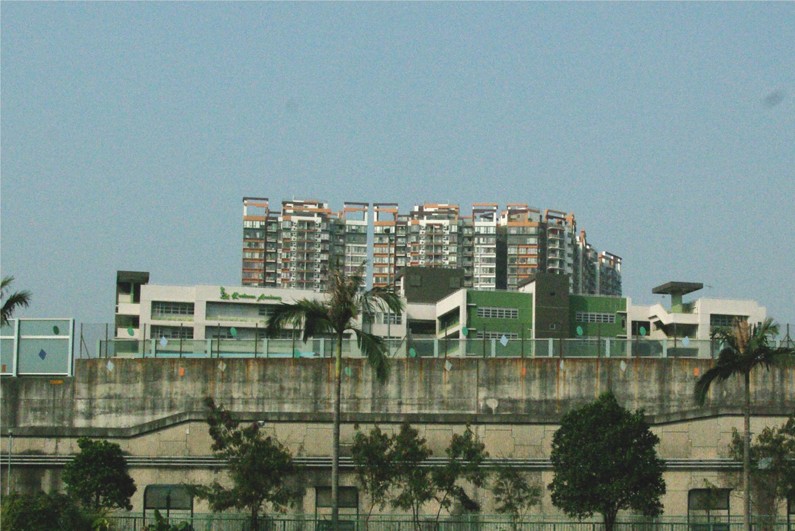
Yuen Long New Town centre comprises mainly high-rise and high-density developments up to 40 storeys. In the southern part are medium-intensity residential developments of around 20 storeys. To the northwest of the Study Area are Tin Shui Wai New Town and the proposed Hung Shui Kiu NDA now under study. |
|
|
The developments near and in the PDA are low-density and low-rise (2-3 storeys) buildings and village housing. There are also many temporary structures. |
|
|
To the south of the PDA are Tai Lam Country Park and Conservation Area. The ridgeline of Tai Lam Country Park with the high point at Ma Shan Mountain Peak (about 290m) forms the natural backdrop for the Study Area. |
|
|
The two nullahs in the PDA (i.e. Yuen Long Nullah and Tin Tsuen Channel) help define the urban structure. Yuen Long Highway is a major transport corridor for the Study Area and defines the northern edge of Yuen Long South. |
 |
Yuen Long South is segregated from Yuen Long New Town by Yuen Long Highway. In view of this unique urban-rural context and the physical segregation, consideration will be given to the ways to strengthen the connectivity of Yuen Long South with the surroundings. |


